Mullikan Cemetery
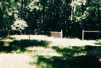
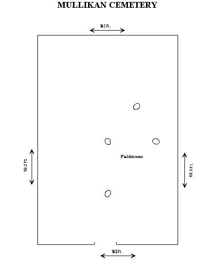
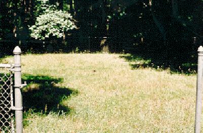
The Mullikan family cemetery is a lonely place. Though the yard measures about 60' x 40' only four fieldstones are left. We have no information on the family though their descendants still reside nearby in Prince George's County and no indication of any engraved stones to tell their story. The site lies northwest of the Woodward cemetery in Range #10, formerly Range #12, at the eastern edge of the North Tract along Wildlife Loop. Driving onto Range #10, take the second trail to the right (north) and just before it opens out into the marshy area at the back of the range there is another turn to the right which ends at the fenced enclosure in a flat clearing in the woods.
There are several foundations of buildings along the road leading to Mullikan, however, which makes the trip worthwhile. The original use of these extensive structures is unclear but they appear on the 1922 Ft. Meade map and additional research is needed to identify them.
Only a few field stones are left:
Detail of 1976 Ft. Meade map:
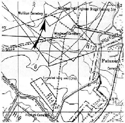
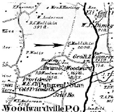
Detail of 1878 Hopkins map.
CEMETERY NO. 17 - MULLIKAN CEMETERY
Located off Boundary Rd. in Impact Area of Range No. 9 (Old range #. Now Area F via Range 12)
1976 Ft. Meade Map Coords: 48,24
LAT/LON: 39o03'59" x 76o44'99"
Number of Graves Unknown: Gravestones obliterated